
Nearly 180 sq km of Madikeri Western Ghats Classified as High Landslide-Risk Zone

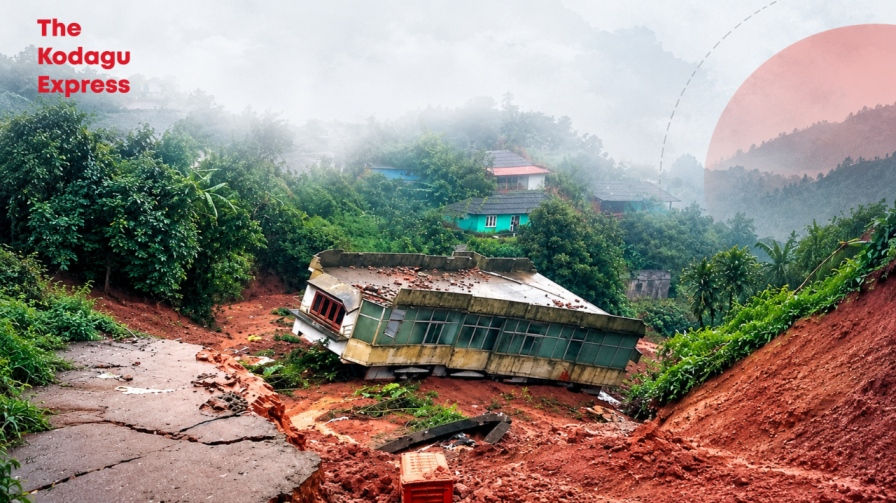
Madikeri/Mangaluru: Nearly 180 square kilometres, accounting for more than 16% of the Western Ghats area studied in Madikeri, has been classified as being under high or very high susceptibility to landslides, according to a study by researchers from the National Institute of Technology (NIT) Surathkal.
The researchers assessed an area of 1,080 square kilometres in the Western Ghats of Madikeri to understand the factors contributing to landslide vulnerability. Their analysis found that 136.61 square kilometres, or 12.58% of the study area, falls under the highly susceptible category, while another 39.84 square kilometres, representing 3.67%, is classified as very highly susceptible. More than a quarter of the region examined was also found to have moderate susceptibility to landslides, according to a report in Bangalore Mirror.
The study identified prolonged rainfall and human interventions that alter slopes and natural drainage systems as key factors influencing landslide risk in Kodagu. Researchers noted that even moderate rainfall can become hazardous when it persists for extended periods, as continued water infiltration increases soil moisture, groundwater levels and pore-water pressure, thereby reducing slope stability.
“We analysed rainfall and landslide data from the past 10 years and found that most of the recorded landslides occurred on moderately steep slopes during periods of prolonged rainfall,” said Shreekant Aditya of NIT Surathkal.
Researchers also highlighted the impact of increasing development in the region. Road construction, widening and cutting, along with slope alterations for plantations, can disrupt natural drainage patterns and change the stability of hill slopes.
According to the study, areas located close to roads and geological lineaments showed greater susceptibility. The researchers observed a notable risk within approximately 300 metres of roads and 500 metres of geological lineaments.
The conversion of forested land into plantations and other changes to natural terrain were also identified as factors affecting slope stability. Such interventions can alter the movement of water through the landscape and increase the possibility of slope failure.
Analysis of rainfall records spanning a decade further indicated a shift in rainfall characteristics in Madikeri. The researchers observed an increasing prevalence of moderate rainfall occurring over longer periods, rather than only short-duration, high-intensity rainfall events.
The study stressed that landslides are caused by the interaction of several factors and cannot be attributed to rainfall alone. Since slope failures can occur within a few hours, researchers said detailed, high-resolution rainfall information is important for understanding landslide events and improving early warning and risk assessment.
NIT Surathkal professor Basavanand Markandeya Dodamani said recent development in some areas had involved tree removal and inadequate slope maintenance.
“When roads are cut through such areas, proper embankments are essential because vertical slope cuts can accelerate slope failures,” he said.
He also pointed to groundwater recharge structures in parts of Madikeri, cautioning that poorly planned installations could increase water infiltration into the soil and reduce its shear strength.
“Such structures need to be designed and constructed with considerable care,” Dodamani said.
The researchers said landslide susceptibility assessments and disaster-management plans in the Western Ghats should account for prolonged rainfall as well as human-induced changes to slopes and drainage systems.
If you appreciate our work, please consider supporting us with a donation. You may contribute via Google Pay, PhonePe or Paytm at: 9980855901
To advertise on The Kodagu Express website, kindly call us at 9108795369 or mail us at thekodaguexpress@gmail.com
Join The Kodagu Express WhatsApp Group: CLICK HERE
Follow us on Instagram and X(Twitter)


Comments